Anne Frank Tree exhibit to be dedicated today at Clinton Center

AnneFrankTree
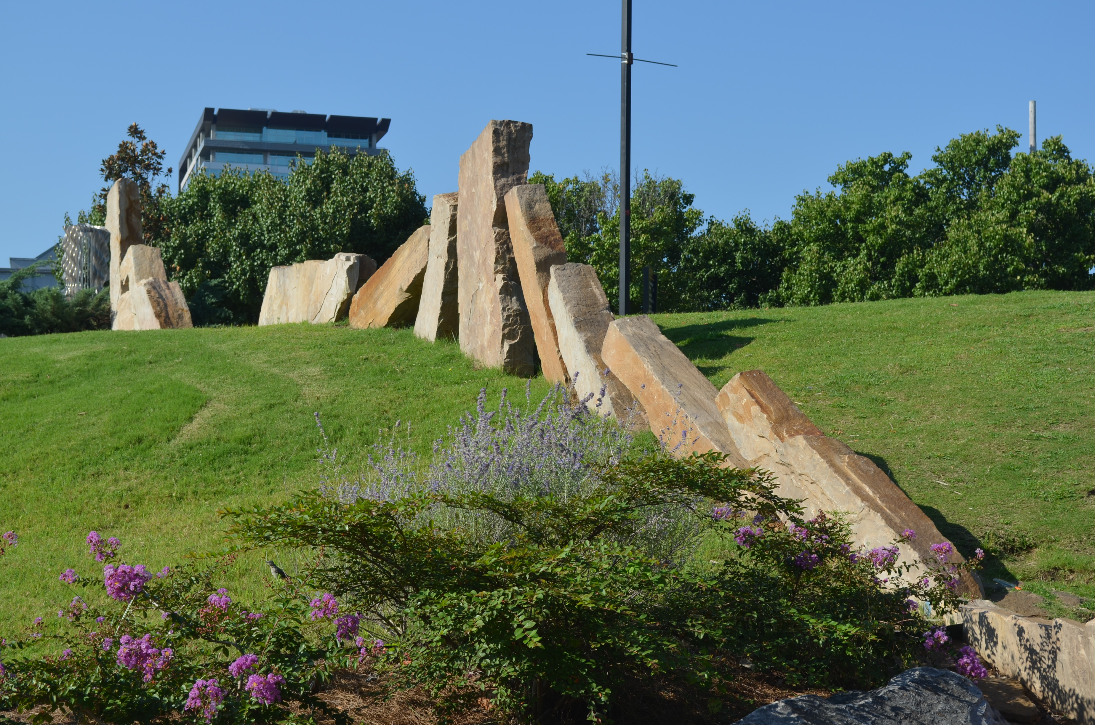
The Clinton Foundation and the Sisterhood of Congregation B’nai Israel, in conjunction with the Anne Frank Center USA, have joined together to create a new powerful exhibit, The Anne Frank Tree, which will be located on the grounds of the Clinton Presidential Park.  The permanent installation, which will surround the Anne Frank Tree sapling, will open today.

In 2009, the Clinton Center was one of 11 entities in the United States to be awarded a young chestnut tree by the Anne Frank Center USA’s “Sapling Project.” The sapling was taken from the white horse chestnut tree that stood outside Anne Frank’s Secret Annex when she and her family were in hiding from the Nazis during World War II. The young writer cherished and wrote about the tree frequently in her famous diary.

“As long as this exists,” Anne wrote on February 23, 1944, “how can I be sad?” During the two years she spent in the Secret Annex, the solace Anne found in her chestnut tree provided a powerful contrast to the Holocaust unfolding beyond her attic window. And as war narrowed in on Anne and her family, her tree became a vivid reminder that a better world was possible.

Anne’s tree would outlive its namesake by more than 50 years before being weakened by disease and succumbing to a windstorm in 2010. But today, thanks to dozens of saplings propagated in the months before its death, Anne’s tree lives on in cities and towns around the world. The Anne Frank tree saplings provide an opportunity for these sites to tell the story of Anne Frank and connect it to incidents of injustice witnessed in each locale. To date, seven saplings have been planted at locations as diverse as the U.S. Capitol and the Children’s Museum of Indianapolis.

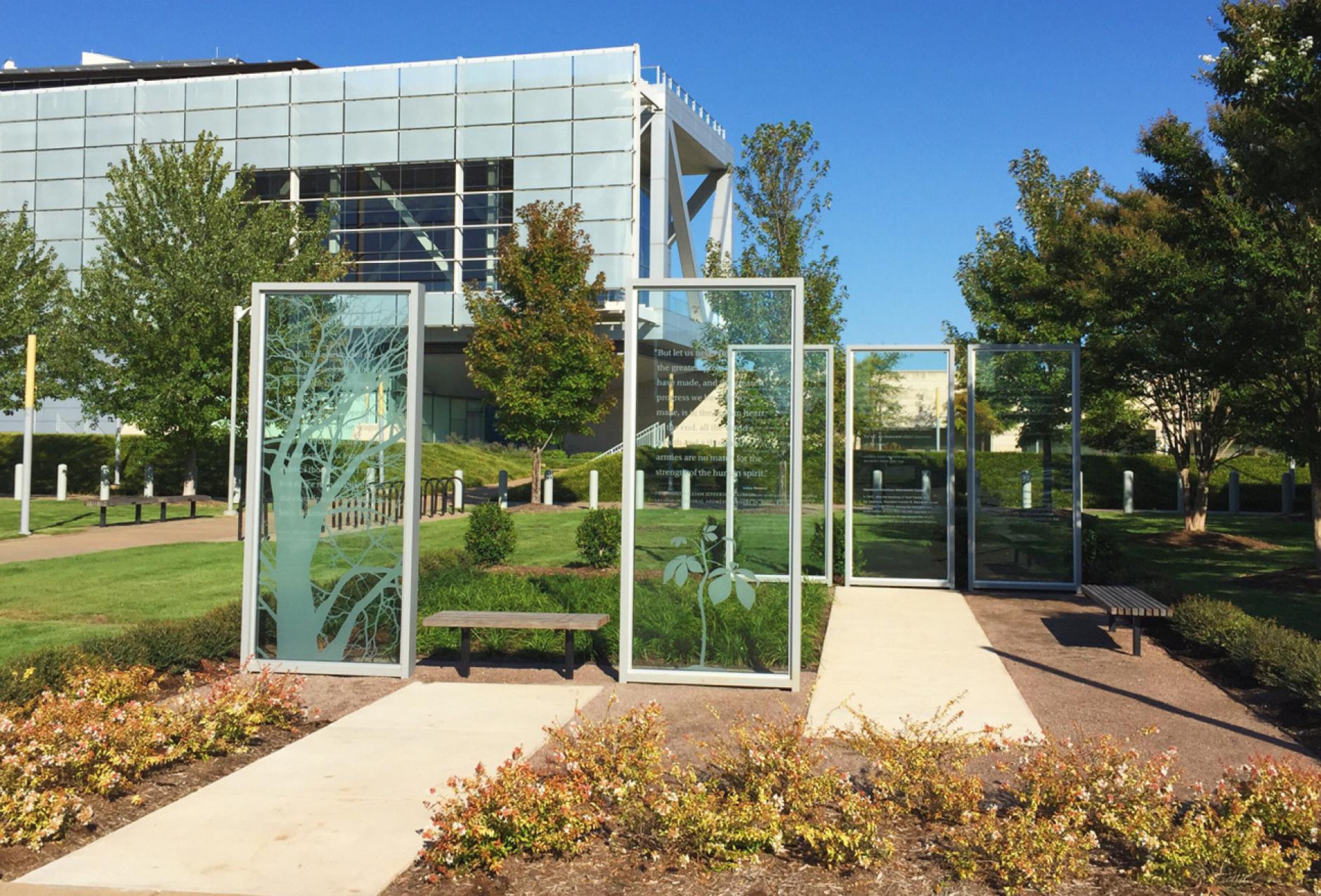
The Center’s installation consists of five framed, etched glass panels – arranged to evoke the feeling of being inside a room – surrounded by complementary natural landscaping. The two front panels feature quotes from Anne Frank and President Clinton. The three additional panels will convey the complex history of human rights in Arkansas through descriptions of the Indian Removal Act of 1830, the internment of Japanese Americans during World War II, and the Little Rock Central High School desegregation crisis of 1957. These panels will feature quotes from Chief Heckaton, hereditary chief of the Quapaw during Arkansas’ Indian Removal; George Takei, Japanese-American actor who was interned at the Rohwer Relocation Center in Desha County in 1942; and Melba Patillo Beals, member of the Little Rock Nine.

In collaboration with the Clinton Foundation, Little Rock landscape architect Cinde Drilling and Ralph Appelbaum Associates, exhibit designer for both the Center and The National Holocaust Museum, assisted in the design of the exhibit. The installation has been made possible thanks to the support of the Ben J. Altheimer Charitable Foundation and other generous partners.

The Center’s sapling is currently housed in a local nursery where it is acclimating to Arkansas’s environment. And although it will be present during the ceremony, it will be returned to the nursery where it will be cared for until it has matured and can thrive in its new home, located on the grounds of the Park. A similar chestnut tree will be temporarily planted in its place until the Anne Frank tree can be permanently transplanted.

Little Rock Look Back: The Quapaw Line

Stones placed in Riverfront Park denote where there Quapaw Line started from La Petite Roche

Stones placed in Riverfront Park denote where there Quapaw Line started from La Petite Roche

On August 24, 1818, the Quapaw Line was drawn.  Starting at La Petite Roche and heading due south, this line formed the boundary between the Quapaw tribe lands and public lands available for settlement.  Though by 1824, the Quapaw were forced to give up all of their lands, the line continued serve as an important marker.  In the ensuing six years, the first permanent settlement of Little Rock took place and streets were planned.

It is interesting to note that the 1818 treaty referred to La Petite Roche as the Little Rock.  Some have speculated that this is the first official use of “Little Rock” to designate the outcropping.  When the Post Office was established in March 1820, it was given the name Little Rock.

There is a marker commemorating the beginning of the Quapaw Line located at La Petite Roche in Riverfront Park.  The first segment of the line is also noted in the park.  There are also sunken markers place along the line at various points.  In MacArthur Park, at the corner of 9th and Commerce Streets, there is a marker noting that the line passed through at that location.

A good account of walking the Quapaw Line through downtown Little Rock can be found on this website.

Most of what is now called the Quapaw Quarter was located to the west of the Quapaw Line.  However, it did take its name from the fact that the tribe had once lived in that area and was later sequestered to lands near it.  The name for the area was chosen by a committee composed of David D. Terry, Peg Newton Smith, Mrs. Walter Riddick Sr., Dr. John L. Ferguson, and James Hatcher. They had been appointed to a Significant Structures Technical Advisory Committee to advocate for preservation of important structures as a component of the City of Little Rock’s urban renewal efforts.

Revolutionary War battle in Arkansas

Colbert's_RaidBecause Arkansas was part of the Louisiana Territory, and under the Spanish flag, one does not think about there being any Revolutionary War battles being fought on Arkansas soil.  But on April 17, 1783, the British and Spanish skirmished at Arkansas Post.  Sometimes known as Colbert’s Raid, this was part of a four year campaign of intermittent efforts by the British to stop the Spaniards from funneling money and supplies to the colonists via the Mississippi River.

James Colbert, a former British Army captain, led a loose group of British mercenaries as well as anti-Spanish members of the Chickasaw tribe on a series of raids in Louisiana and the lower Mississippi area.  He targeted Fort Carlos at Arkansas Post because of its proximity to the Arkansas and Mississippi Rivers.

The Fort had 33 Spanish soldiers and four members of the Quapaw tribe.  Colbert had over 80 men with him.  After an initial attack on the Post, several residents made it to the Fort which was then attacked.  Expecting surrender (and indeed there had been a brief truce), instead a Spanish sortie of 14 faced the 82. Shouting Quapaw war cries and firing their muskets, under the cover of darkness, this sortie surprised and confused the Colbert party.  Convinced that a large collection of Quapaw was attacking them, they scattered and retreated.

Today, the National Park Service at Arkansas Post offers information on this battle, one of the last of the Revolutionary War (and a full 18 months after Cornwallis surrendered to Washington at Yorktown).

Little Rock Look Back: Drawing the Quapaw Line

quapawlineOn August 24, 1818, the Quapaw Line was drawn.  Starting at La Petite Roche and heading due south, this line formed the boundary between the Quapaw tribe lands and public lands available for settlement.  Though by 1824, the Quapaw were forced to give up all of their lands, the line continued serve as an important marker.  In the ensuing six years, the first permanent settlement of Little Rock took place and streets were planned.

It is interesting to note that the 1818 treaty referred to La Petite Roche as the Little Rock.  Some have speculated that this is the first official use of “Little Rock” to designate the outcropping.  When the Post Office was established in March 1820, it was given the name Little Rock.

There is a marker commemorating the beginning of the Quapaw Line located at La Petite Roche in Riverfront Park.  The first segment of the line is also noted in the park.  There are also sunken markers (such as the one to the left) place along the line at various points.  In MacArthur Park, at the corner of 9th and Commerce Streets, there is a marker noting that the line passed through at that location.

A good account of walking the Quapaw Line through downtown Little Rock can be found on this website.

Most of what is now called the Quapaw Quarter was located to the west of the Quapaw Line.  However, it did take its name from the fact that the tribe had once lived in that area and was later sequestered to lands near it.  The name for the area was chosen by a committee composed of David D. Terry, Peg Newton Smith, Mrs. Walter Riddick Sr., Dr. John L. Ferguson, and James Hatcher. They had been appointed to a Significant Structures Technical Advisory Committee to advocate for preservation of important structures as a component of the City of Little Rock’s urban renewal efforts.

Little Rock Look Back: The Quapaw Line

quapawlineOn August 24, 1818, the Quapaw Line was drawn.  Starting at La Petite Roche and heading due south, this line formed the boundary between the Quapaw tribe lands and public lands available for settlement.  Though by 1824, the Quapaw were forced to give up all of their lands, the line continued serve as an important marker.  In the ensuing six years, the first permanent settlement of Little Rock took place and streets were planned.

It is interesting to note that the 1818 treaty referred to La Petite Roche as the Little Rock.  Some have speculated that this is the first official use of “Little Rock” to designate the outcropping.  When the Post Office was established in March 1820, it was given the name Little Rock.

There is a marker commemorating the beginning of the Quapaw Line located at La Petite Roche in Riverfront Park.  The first segment of the line is also noted in the park.  There are also sunken markers (such as the one to the left) place along the line at various points.  In MacArthur Park, at the corner of 9th and Commerce Streets, there is a marker noting that the line passed through at that location.

A good account of walking the Quapaw Line through downtown Little Rock can be found on this website.

Most of what is now called the Quapaw Quarter was located to the west of the Quapaw Line.  However, it did take its name from the fact that the tribe had once lived in that area and was later sequestered to lands near it.  The name for the area was chosen by a committee composed of David D. Terry, Peg Newton Smith, Mrs. Walter Riddick Sr., Dr. John L. Ferguson, and James Hatcher. They had been appointed to a Significant Structures Technical Advisory Committee to advocate for preservation of important structures as a component of the City of Little Rock’s urban renewal efforts.